Keith Jenkins
Cornell University
(Ithaca, NY)
but seriously...
GIS librarian
So let's talk about data
international data regional data national data state data province data county data district data town data city data municipal data ngo data research data project data satellite data lidar data kite data quadcopter data paper airplane data
data data data data data data data data data
data data data data data data data data data data data data data data data data data data data data data data data data data data data
data data data data data data data data data data data data data data data data data data data data data data data data data data data data data data data data data data data data data data data data data data data data data data data data data data data data data data the data you are looking for data data data data data data data data data data data data data data data data data data data data data data data data data data
data data data data data data data data data data data data data data data data data data data data data data data data data data data data data data data data data data data data data data data data data data data data data data data data data data data data data data the data you are looking for data data data data data data data data data data data data data data data data data data data data data data data data data data

!
Is this a problem?
not for everyone...
local governments already have all their own data
experienced researchers already know where to get their data
but what about the rest of us?
students
researchers
journalists
demographers
gerrymanderers
civic activists
treasure hunters
pubmap creators
kitemap orthorectification specialists
farmers market bikeability analysts
anyone trying to learn more about their world
About 114,000,000 results
who is going to organize this mess?
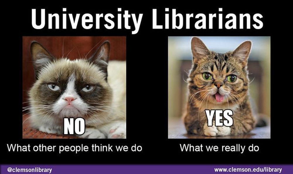
librarians
myth: librarians shush
reality: librarians conquer the chaos of the world by collecting it and organizing it
Or, to put it in terms of cats...
Disclaimer: I'm not really a cat person
(I've just heard that cats make effective visuals)
another myth...
myth: every university needs to compile its own list of links
2007: del.icio.us
2014: geolode.org
what is geolode?
a 7-letter .org domain that wasn't already taken
"the motherlode
of geospatial
data"
lodestone
lodestar
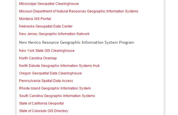
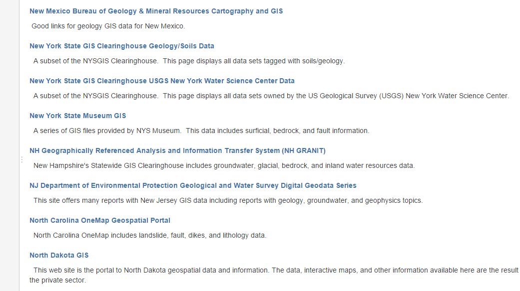
finding geospatial data sources
websites, not data layers
open data, not closed data
How does it work?
extremely lightweight metadata
not this
 this
thistext-only interface
(minimum viable product)
search, browse, filter
place, topic, tag
editing
editor
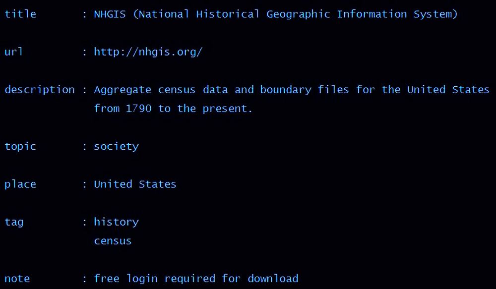
add via bookmarklet
title, url [, description]
markdown in the description
autocomplete for place, topic, tag
history/ versioning
let's review...
what is geolode?
geolode is for finding geodata websites (not data layers)
moving from a solo effort to a collaborative effort
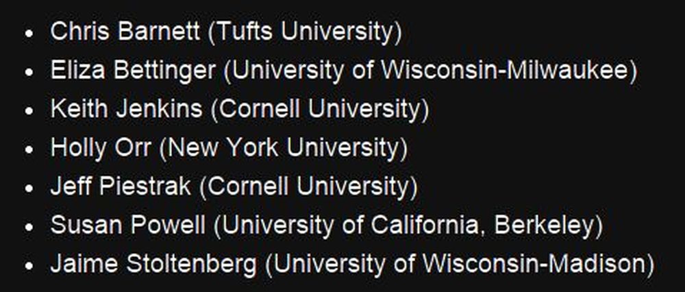
7 volunteer editors so far
What do editors do?
add new items
(currently a bit US-centric)
enhance existing items
remove obsolete items
documentation
draft guidelines
what makes a good description?
"Omit needless words" -- Strunk & White
Use cases
direct researchers to Geolode?
Feed university website with data from Geolode?
refine tags
consider hierarchical places?
Grand River Information Network
Grand River
Ontario
Canada
website rankings?
want to be an editor?
want to suggest websites?
thank you!
questions?